
Marine charts: paper or electronic?
For many years, discussions have been ongoing on internet forums and FB groups about whether paper maps have any use on recreational vessels. Can traditional navigation be abandoned in favor of electronic navigation? Is it safe? Hundreds of questions, and no clear answer to the dilemma. Holding the helm tightly like a pirate clutching his last bottle of rum, sailing purists will shout that no true sailor should leave port without a paper map! Risking lynching, I’d like to write about why we don’t use paper charts and how it came to be.
In the beginning – there was paper…
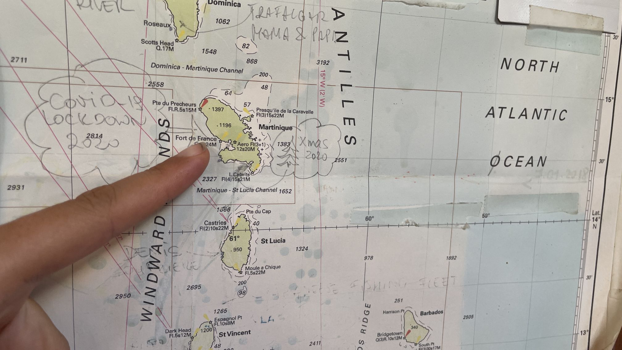
When we set sail six years ago, our yacht (White Dog) was then equipped with a full set of maps for the North Sea, the English Channel (for the French, it’s La Manche, don’t want to risk the guillotine here…), the Bay of Biscay, the Canary Islands, and general maps of the Atlantic. We also had paper versions of the Caribbean islands. Of course, all the above maps were from general to detailed charts of specific approaches to major ports – estimating a good 10-15 kg of paper. And here the first problem arose: where to fit it all…

A traditional navigation table, like any nav table on every boat I’ve known, is a place to put everything. Maps, if they even fit at all there, lie glued together and buried under a ton of junk. It’s the most cluttered place on the yacht. I bet, even a decklocker/lazaret where you throw everything randomly doesn’t have as much stuff (counting by items) as the navigation table. Our maps ended up under the mattresses in the saloon, and most of them laid there for years until the so-called “final solution”*.
*The final solution happened in Mexico, where we got bugs and we decided to throw out everything that could contribute to their proliferation… and bugs love paper maps…So when did we use paper charts?
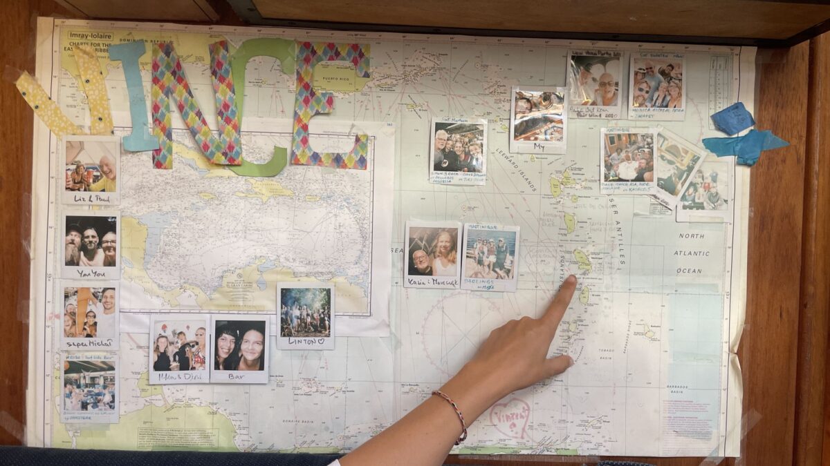
When we had general charts, we used them for planning of the long passages, such as from Amsterdam to the Canary Islands or across the pond. We also used paper maps when teaching our son how to mark positions on a map and read a course. Paper maps served also their role as wrapping paper for gifts…. (At this point, in the imagination of the orthodox sailors I’m getting hit with a boathook over the kidneys! I can feel it!). A paper map hangs on our wall. We mark on it where we’ve been and where we’re going, and who we met and where. It’s full of drawings and photos. And that’s really all about it.

Why, oh why?
Here, some of you might ask: – but why? After all, traditional navigation on a map is fun: marking the position every 4 hours (or two), plotting the course…, and those declination and deviation calculations…. Yummy! Well, when you live permanently on a boat and sail from one island to another for several years in the lets say…Caribbean, sometimes you don’t even turn on the plotter. It’s like entering your daily route to work into your car navigation system every single day. Do you do that? Honestly… do you? I don’t. Traditional maps also need space to be spread out somewhere to perform this navigational gymnastics… On the navigation table rules the computer, the map doesn’t fit. On the table, you say?… that’s where the child is learning math, throwing a glance saying “why do I need the area of a triangle if everything in Minecraft is square…”
But what if your electronics fail…
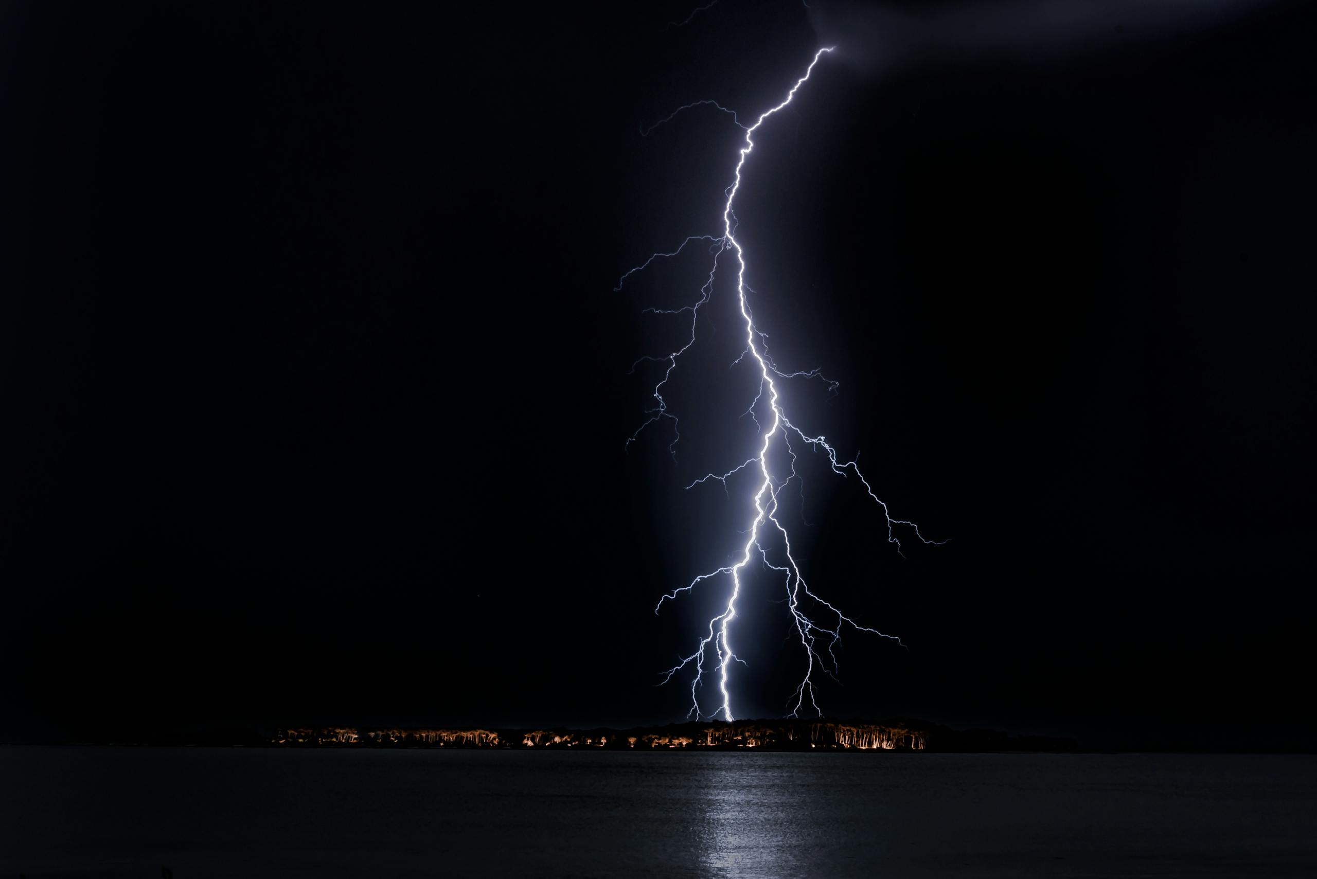
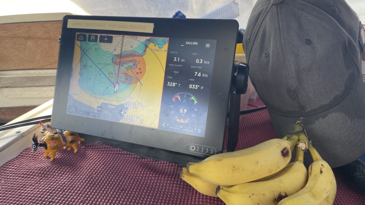
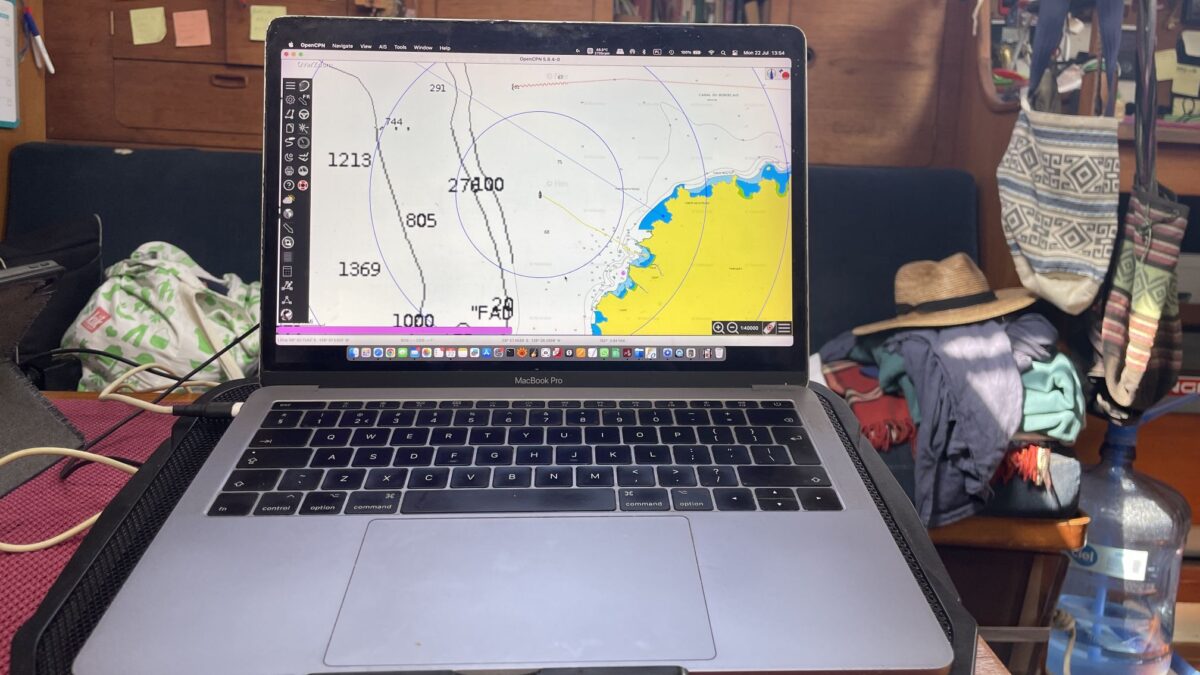
…the map will save you… Yeah, you know how many different devices on our boat have maps… offline… Well: the main plotter, laptop no. 1, laptop no. 2, mobile phones no. 1,2,3, plus two tablets. Each of these devices also has its own GPS and an application for obtaining GPS data. In addition, if we count the GPS devices alone, we also have a Garmin inReach. When we sail, at least two navigation devices, along with power banks, are in our ditch bag. We would have to be hit by an EMP** for all these devices to fail at once. Even if that happened, we have a sextant, mechanical log, and a lead line on board, on top of that a colored general map hangs on the wall, so we’d probably eventually find some land.
Summarizing…
…we don’t use paper maps for navigation. Not anymore…. We know how to do it, but for convenience, we don’t. We enjoy the benefits of modern navigation, although I believe that traditional navigation and using traditional maps should still be taught in sailing schools. It’s a nice tradition, and having these skills and practicing them is always useful. For us, we navigate on many electronic devices at once, and we no longer use paper charts.
Until next time,
smooth sailing and may your anchor always find good holding ground.
Ahoy, mateys! 🌊⚓️


Regarding Paper vs. Electronic charts, I completely agree with you. When I was taking my instructor rating, I opined that we should be spending a lot more time on electronic charting systems since that’s what people mostly use. “Well, what if that dies?” is the rather common responsed I get. “Then I turn on my second chart plotter”. “What if that dies too?” “I pull up my tablet.” “And if that dies?” “I pull out my second tablet.” “And if that dies?” “My laptop…” “and that dies too?” “My cell phone”, etc. on through all my crew’s cell phones as well. “And if they all die?” “If we are having that much bad luck, we’re probably sinking and it’s all moot anyway as we won’t be doing much navigating in the life raft.”
Of course, as you say, EMP could be a problem. Like you, I put a few devices in the microwave just in case, during a thunderstorm.
That’s my sentiment exactly. We have all the traditional navigation equipment (sextant, speed log, even a lead line for depth and ground probing) on board, and even more importantly, we know how to use it. We were trained to use it, as we were sailing before GPS became popular—especially in Poland. Hell, we even know how to enter a marina and dock under sail. But the last time we used our sextant was during an Atlantic crossing in 2008—just for fun, last time we docked under sail was in 2018 in Canary Islands – the engine broke and the last time used the traditional speed log was this year when crossing the Pacific to show our 13-year-old how speed was measured in the dinosaur era 🙂 🙂 :).
Też używam nawigacji, ale papierową mapę mam zawsze. Na wypadek nie działania GPS. Za dużo przypadków ostatnio jest zakłócania sygnału GPS. Glonass też przestaje działać;)